If you’re looking for rural property, you can save yourself a lot of time by doing thorough “virtual” scouting before you set foot on the property. Taking a look at the property directly can help you determine whether it is the right fit for you, before you commit to the time and energy to travel to see it yourself.
Thankfully, there’s a tremendous range of tools available to help achieve this task. Here’s a few options, all of which can be accessed free on the Internet. Once you’ve found a property of interest, whether on SurvivalRealty.com, another real estate website, or on the MLS, make note of its street address, latitude & longitude, or parcel number for further research.
Parcel Data
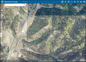
Start by looking up the parcel in the local government’s GIS (Geographic Information System). You can generally find a portal for your area with a google search like “Bonner County Idaho GIS.” These portals, administered by local government, can provide a wealth of information on acreage, parcel ownership, zoning, and more. Combined with searching records from the county assessor or recorder, and you’ll get a good overview of the property’s history and specifics.
If your real estate agent has access to a tool like MapRight, they will be able to quickly generate a parcel map for any subject property. Other tools like OnX and Landglide also allow easy parcel mapping, but may require a subscription to access some features.
Satellite/Aerial Imagery
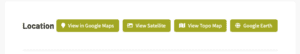
The most readily accessible platform for mapping is still Google Maps or Google Earth. Their convenience and easy search tools are unbeatable. Unfortunately they don’t provide detailed parcel data, so they are best suited to gaining an overall sense of the area.
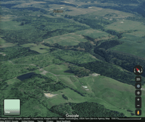
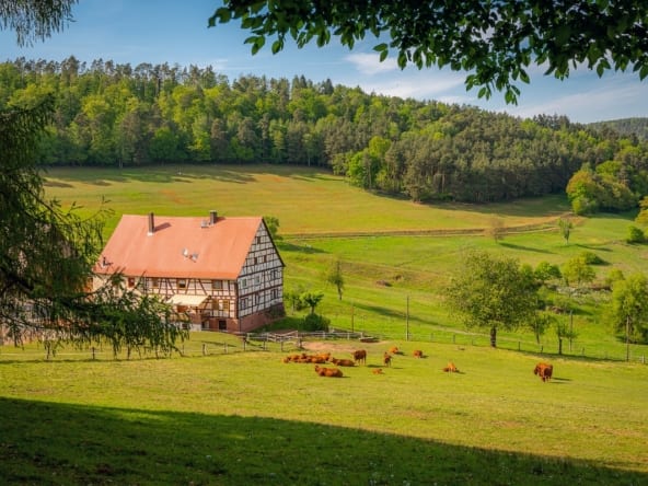
Look not only at the property you are interested in, but the surroundings–you may find large natural areas, farms, or perhaps new subdivisions, gravel pits, or nuisances instead. The bird’s eye view will reveal things you may even miss when driving through the area.
Topographic Maps
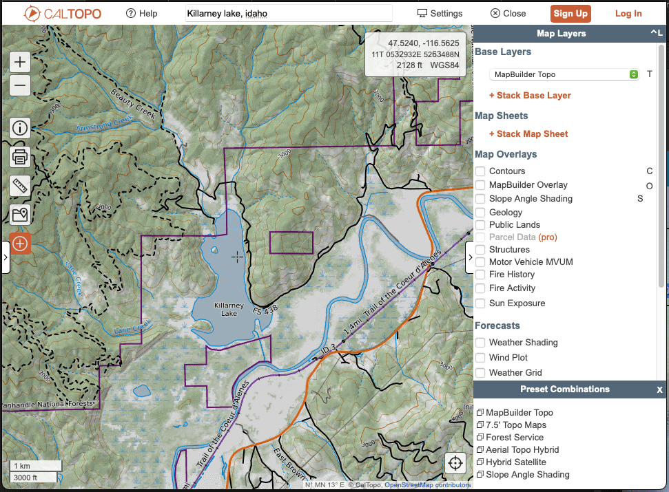
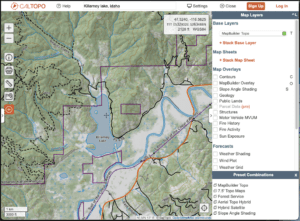
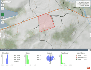
One of the most versatile mapping tools is Caltopo. Access to their parcel boundary maps does cost $50/year, but there are great features even without it.
There’s a great variety of map layers, including USGS and Forest Service topographic maps, satellite imagery, and shaded relief. The contour map options allow a more precise view of a parcel’s topography.
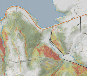
The Slope Angle Shading feature provides a heatmap-style view of the terrain, allowing you to easily distinguish between flat, rolling, and steep slopes.
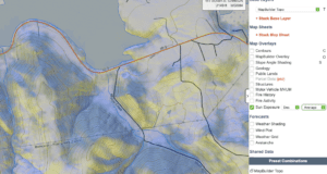
For those that don’t enjoy reading contour lines on topographic maps, the Sun Exposure tool provides a quick indication of property aspect–answering the “northern or southern exposure” question.
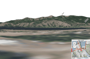
Caltopo’s more advanced tools can provide a Simulated View from any location (think of google street view), display the elevation profile of any line, and find terrain statistics for a selected polygon including slope, aspect, elevation, and ground cover.
Did you know that most property listing at SurvivalRealty.com include a link directly to Caltopo, along with our other mapping options? Check it out and see almost any property from home.