- Property Search
-
-
- LISTINGS BY STATE
- Arizona
- Virginia
- Idaho
- Montana
- Tennessee
- Colorado
- Nevada
- Washington
- Texas
- Wyoming
- Alaska
- North Carolina
- Arkansas
- New York
- New Mexico
- California
- Oregon
- Alabama
- Florida
- Hawaii
- South Carolina
- New Hampshire
- South Dakota
- Minnesota
- San José Province
- Indiana
- Commewijne District
- West Virginia
- Pennsylvania
- Wisconsin
- Maine
- Vermont
- Kentucky
- Ohio
- LISTINGS BY STATE
-
Don’t Miss Out
Get our newest property listings via email
-
- Find an Agent
- Advertise
- Resources
- Book

Overview
Property ID: SR172606
- Vacant Land
- 120
Description
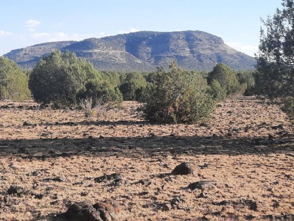
The photo is not the exact mine marketed
PROERTY access is limited, Deeded fee property with mineral rights, old tailings through out property
4×4 required, all structures are gone, horizontal and vertical shafts are present, open pits on property, very unique property,
LELAND MINE. HERE IS THE HISTORY OF THIS MINE :
Location. The Leland mine (Pis. XIII, B; XIV) is located just west of Vivian, on the western part of the Leland vein, in the upper part of Leland Monument Butte. The elevations vary between 2,400 and 3,000 feet.
History and developments. The Leland property is reported to have been purchased from earlier owners in 1902 by Col. Thomas Ewing, who in 1903 sold it to the present company, the Mohave Gold Mining Company (which until January, 1907, was known as the Mount Mohave Gold Mining Company). Common reports give the price as $550,000. The property comprises a group of eight patented claims, of which the Leland and the Mitchell are the most important.
Immediately after the acquisition of the property the company began developments and operations on an unusually large scale. It installed a 12-chute ore bin at the mine at a ost of over $26,000 and a 4-0-stamp mill at a point which later became known as Milltown, 11 miles southeast of the mine, about 5 miles from the river, in the open, flat valley of the Colorado 6 miles from Spears Lake. It also installed a large pumping plant on the Colorado 2 miles belowNeedles, where, with a large. Corliss engine, water was pumped through an 8-inch pipe line to the mill. In conjunction with these developments 17 miles of narrow.-gage railway, the Mohave and Milltown Railroad, was built by an auxiliary company, it is said, at a cost of $268,000, from the east bank of the Colorado opposite Needles via Milltown to the mine. The freight and ore were taken across the river by ferry at Needles, where connection was made with the Santa Fe Railway.
With these equipments, installed at a cost exceeding $400,000, the company operated for a period of two years, principally during 1903 and 1904, and then closed down, mainly, it is stated, on account of failure to save the gold values in the ore at the mill. However, the company plans to resume operations in the near future, particularly in case the Midnight mine, which is now producing, continues to yield well.
The equipments above described remain at the mine. Of the 6 or 7 miles of railroad between Milltown and Needles, all but about 2 miles is said to be washed out by the flood water of the Colorado.
During the two years of operation a large amount of work was done in the mine and about 4,500 tons of ore was milled. The mine is developed by adit drifts, tunnels, shafts, winzes, and stopes, aggregating about 3,000 feet of underground workings, distributed within a horizontal distance of about 3,500 feet and a vertical range of about 700 feet.
The most extensive part of the work is in the east side of Monument Butte, where the principal engines, ore bin, and railroad terminus are located. Here the tunnels or drifts on the lower tunnels exceed 800 and 700 feet in length and have tram connections with the ore bin. On the upper levels, toward the crest of the butte, in a vertical range of about 200 to 300 feet, extensive open-cut mining has been done and here the vein contains a width of 4 to 5 feet of very good-looking greenish quartz ore.
From the west side of the butte work on the two lower levels extends in about 600 and 500 feet, and this work is said to lack but about 125 feet to connect with that projected from the east. The portion of the vein contained between a level situated about 25 feet above the farthest 40 feet of the lower drift and the surface about 170 feet above it has been stoped out. The stoping apparently followed the richest ore only, much of which is reported to have averaged from $50 to $60 in gold to the ton.
The production of the mine was not learned, but of the 4,500 tons of ore milled a considerable amount is reported to have averaged $15 a ton and some from $50 to $60 a ton. Owing, it is said, to inefficient handling in milling a considerable amount of the gold values put through the mill was not saved.
Geology. The country rock is the green chloritic andesite and latite, which in some parts of the mine is allied to quartz monzonite porphyry. A microscopic slide of a fresh black specimen collected in the lower east tunnel consists of a microcrystalline fine-grained groundmass of feldspar and a little quartz in which are embedded phenocrysts of orthoclase and plagioclase. In the lower part of the mine on the extreme west the chloritic andesite gives way to the underlying older andesite and is here intruded into it in the form of dikes, as has been described. A close sheeting, which seems to be the dominant structure, strikes N. 70° W. and dips 70° N. A secondary coarser sheeting or jointing strikes N. 22° E. and dips 70° E: The black phase of the rock seems to contain considerable iron, which in some places on the upper northeast shoulder of Leland Butte renders the compass unserviceable.
Veins and ores. The mine is located on the western part of a well-marked fissure vein, known as the Leland vein. This vein has a known extent of about a mile, strikes about N. 70° W., and dips about 75° S. At the mine it ranges from about 5 feet in width on the east to about 25 feet on the west. It is of the Gold Road type, being composed essentially of pale-greenish quartz and microscopic adularia, locally accompanied by calcite or spar and country-rock fault breccia, and it is usually frozen to the fissure walls. The vein is reported to contain more or less regularly throughout the mine a large amount of good ore averaging from $5 to $10 in gold to the ton. Locally the vein contains vugs lined with quartz crystals and black pulverulent oxide of manganese; many of these vugs carry much fine free gold.
The croppings of the vein consist of stained quartz and country rock containing stringers and veinlets of quartz and calcite; they are usually prominent, rising from 5 to 20 feet above the surface, and at the top of the butte they attain a width of about 40 feet, where they are locally split by a horse of the more or less silicified country rock 25 or 30 feet wide, which is traversed by stringers and veinlets of quartz and calcite and bounded on either side by 3 feet of vein quartz representing the vein, the portion on the hanging-wall side being the stronger and more persistent and direct in course. On a considerable portion of the western slope of the butte the hanging-wall side of the vein rises almost perpendicularly 60 to 80 feet above the surface and the vein is about 25 feet in width. At the west base of the butte, however, where it encounters the contact of the green chloritic-andesite with the older andesite, this great vein almost abruptly ends, and
it is not represented in its projected course or elsewhere in the older andesite beyond the contact. The contact, however, seems to be in part a fault contact as well as an eruptive one, as is shown where it is crossed by the lower tunnel on the west at about 100 feet in from its mouth.
East of the mine, particularly where the vein crosses the ridge on which the residence buildings stand, on the eastern part of the Boston claim, the croppings are 10 or 12 feet in width. They rise 5 or 6 feet above the surface and consist mostly of light-colored, more or less coarsely crystalline calcite or spar and quartz.
Another important vein at the Leland mine is the Mitchell vein. It is located about 400 feet south of the Leland vein, as shown in figure 30, and lies about parallel with it, but dips steeply to the north. It is opened at the south base of Leland Butte at about the same elevation as the lower drifts on the Leland vein by a 100-foot shaft and a 60-foot tunnel connected by tramway with the large ore bin. At the time of visit the shaft contained about 40 feet of water. The croppings at this point consist of a dark-stained ” iron cap ” of quartz, calcite, and rock several feet in thickness, resting like a detached cover on the underlying portion of the vein.
The principal opening is the shaft, but the tunnel shows some excellent examples of pseudomorphic quartz, which has replaced calcite. The vein consists of 7 feet of crushed and brecciated quartz, calcite, and country rock. The quartz is relatively pure toward the hanging wall, but grades into a breccia of calcite, quartz, and seamed country rock. This vein, where sampled 60 feet below the surface, is reported to average about $8.50 in gold to .the ton, or about the same as the Leland vein, while the rich streak of quartz on the hanging-wall side is claimed to average about $100 a ton.
Though no trace of the Leland vein occurs in the older andesite beyond the contact of the country rocks on the west, the Mitchell ledge seems to be represented there by sporadic croppings of impure dark-stained quartz or silicified rock and a little calcite, the quartz possibly being a replacement of calcite. Other croppings of a similar character occur near by, and most of them are associated with the intrusive green chloritic andesite dikes.
Although no sinking has been done to exploit the Leland ground below the lower workings above described, the ore on both the Leland and Mitchell veins, except in the extreme western part of the mine, very probably continues in depth coextensive with the green chloritic andesite to a level about 230 feet below the present lower level of the mine, or the drift commonly known as ” Tunnel No. 3.”
In the light of this conclusion the widely held theory that by sinking to a depth of 1,200 or 1,500 feet at a point midway between the Leland and Mitchell veins a large body of ore will be encountered at their junction should be accepted with caution, for the lower limit of the green chloritic andesite seems beyond doubt to lie at too shallow a depth for the veins to meet in this formation.[1]
Details
Updated on May 17, 2026 at 12:13 pm- Property ID: SR172606
- Price: $225,000
- Land Area: 120
- Property Type: Vacant Land
- Property Status: For Sale
- Address Oatman, AZ, USA
- County Mohave County, Arizona
- State Arizona
- City Oatman, Arizona
- Country United States
Contact Information
View ListingsThis listing is a paid advertisement presented on behalf of a licensed real estate professional or a property owner. Property ad content is the sole responsibility of the advertiser. Land features, descriptions, details, directions, sales history, photos, maps, boundaries and files are deemed reliable and provided "as is" without guarantee, warranty, representation, expressed or implied by SurvivalRealty.com or its partners. All information may be subject to errors, omissions, sale, or withdrawal. Contact the advertiser directly using the contact form or other provided contact methods for all inquiries regarding this listing.
Access to and use of SurvivalRealty.com or its content is subject to our Terms & Conditions.
Similar Listings
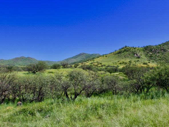
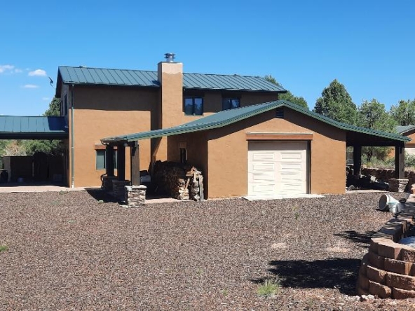
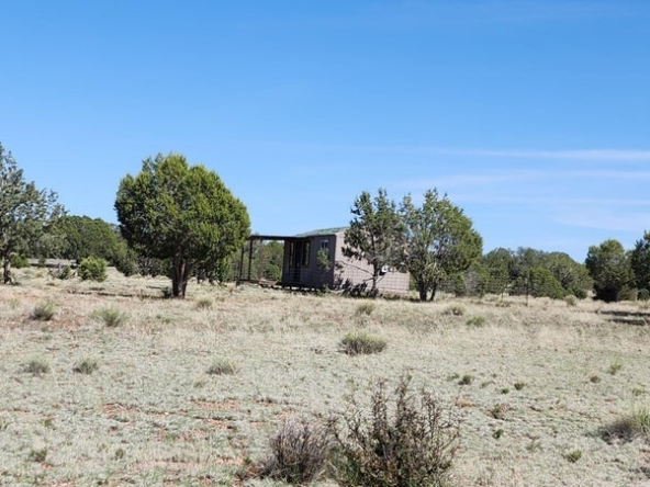
Ultimate Remote 37.7 Acre Build-Ready Retreat with Well, Power & Septic – Salero Ranch, AZ
34 Muledeer Drive, Rio Rico, AZ, USA Details
2 years ago
